MapKit and ESRI ShapeFiles

The following is a guest post by Al Tyus and originally appeared on his blog. Al is currently in the iOS-000 class at The Flatiron School. You can follow him on Twitter here. Why Use ShapeFiles? While MapKit provides a super easy way for we dev folk to utilize geographical data in our apps, you’ll quickly realize that […]
The following is a guest post by Al Tyus and originally appeared on his blog. Al is currently in the iOS-000 class at The Flatiron School. You can follow him on Twitter here.
Why Use ShapeFiles?
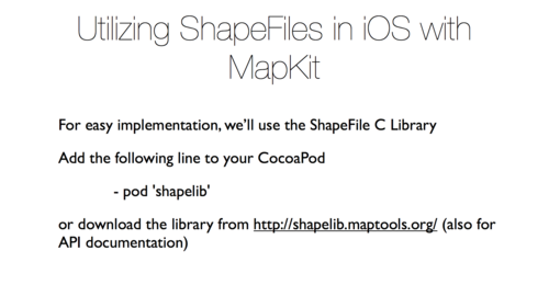
While MapKit provides a super easy way for we dev folk to utilize geographical data in our apps, you’ll quickly realize that it doesn’t do much without a data source. In today’s post and corresponding meetup http://www.meetup.com/NYC-NSTalks/ , I’ll outline using ESRI ShapeFiles as a powerful static data source for generating MapKit Overlays.
Slides
Links
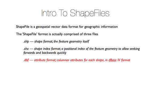
http://en.wikipedia.org/wiki/Shapefile
http://nsscreencast.com/episodes/66-processing-shape-files
http://cocoapods.org/?q=shapelib
http://www.statsilk.com/maps/download-free-shapefile-maps—
Disclaimer: The information in this blog is current as of October 18, 2013. Current policies, offerings, procedures, and programs may differ.